Storm surge is sort of the uninvited and forgotten Uncle who shows up at an already bad party and makes sure everyone goes home unhappy.
When we track hurricanes the headline is inevitably the winds. The fact is, though, it’s not the winds causing the majority of the damage. It’s the water.
Rainfall contributes to that—6”-10” in 10 to 12 hours is a lot of rain. But what is really the most destructive force is the storm surge.
As a basic primer on storm surge there is some great information on the National Hurricane Center website. Click here to access.
Along the Outer Banks there are actually two component to storm surge.
There is the storm surge that batters our beaches. It’s spectacular. If you’re standing on the beach when a 5’ storm surge is rolling in with 12’ waves pushing to shore, it’s downright dangerous. And it does wreak havoc with buildings and infrastructure located along the beach.
However, the most destructive storm surge is often away from the beach and in the inland waters of coastal North Carolina.
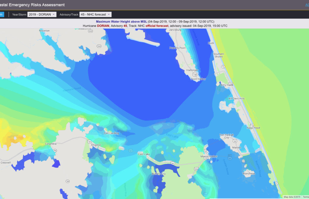
For the most part the rise and fall of waters in the state’s sounds are wind driven tides. People in Kitty Hawk, as an example, are well aware that when there’s a southwest wind, the waters of Kitty Hawk Bay rise noticeably. A northeast wind and the bay becomes a mudflat.
For the most part, the shoreline and the environment have no problem dealing with those fluctuations. In a tropical system, though, all bets are off.

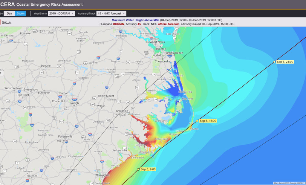
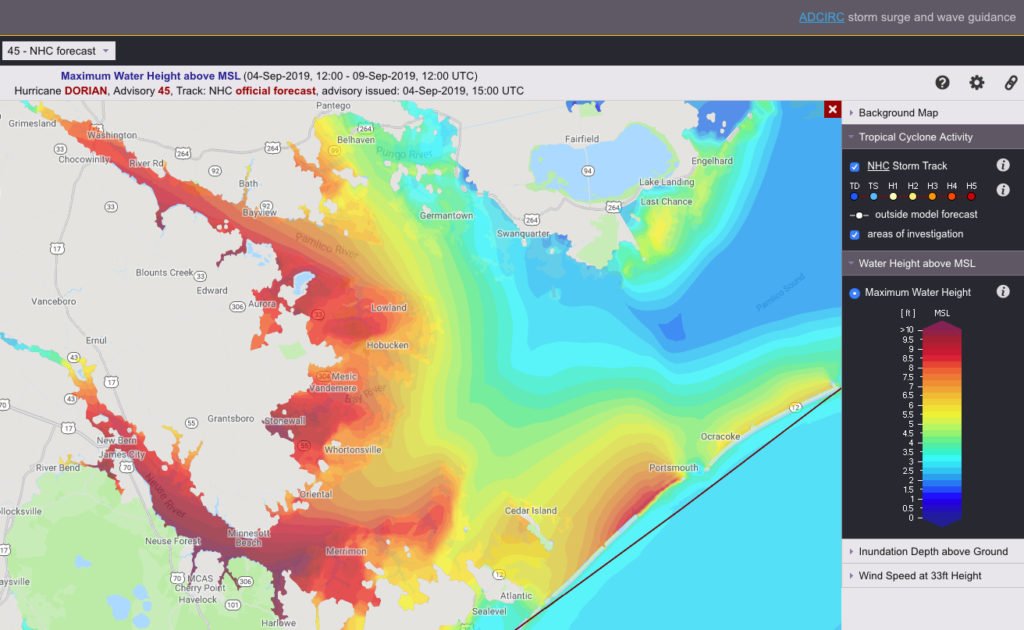
A 15 or 20 mph wind can create a significant wind tide. A 75 or 80 mph wind has the potential to create a catastrophic wall of water. Making the natural wind tide potentially more destructive is the massive amount of water being forced into the sounds though the inlets by the storm surge. Add to that the 6”-10” of rain and in places like the town of Washington on the Pamlico River, or New Bern on the Neuse and a storm surge of 8’-9’ become possible and in the case of Dorian, predicted.
Contributing to the storm surge in those towns is their location on rivers. The initial direction of a hurricane’s winds are from the northeast, pushing the waters to the southwest, where the Neuse and Pamlico rivers are located on Pamlico Sound.
The volume of water does not change when it gets to the rivers. Constricted by the rivers’ banks the only place for the water to go is up.
There will also be storm surge on the soundside of Hatteras Island, but it is predicted to be in the 3-5’ range.

The northern Outer Banks will also see storm surge—predicted at this time to be 3-5’ long the coastline and varying between 2-3’ and 3-5’ on the soundside. That will occur on the backside of Dorian as the winds shift to the northwest, pushing waters from the west to the east.
However, if the forecast holds, and it has been remarkably accurate thus far, the storm will be heading rapidly out to sea when the winds shift. A 5’ storm surge is certainly reason for concern on the soundside which is mostly residential, but with Dorian moving away from the coast, the waters should receded fairly quickly.
Content written by Kip Tabb.
