Dare, Hyde and Currituck counties have all called for mandatory evacuations ahead of the storm.
As Hurricane Florence approaches the coast, consensus is growing that it will make landfall along the North Carolina/South Carolina border. Nonetheless, the power and size of the storm has forced Outer Banks officials to order mandatory evacuations. Connie Leinbach writing for the Ocracoke Observer shares much information.
Florence strengthens, Ocracoke and Hatteras mandatory evacuations and NPS shuts down
This story is updated Monday, Sept. 10, 12:43 p.m.

As this storm approaches, we will have more updates.
Effective at noon, Monday, Sept. 10, the Hyde County Board of Commissioners has declared a state of emergency for all of Hyde County and a mandatory visitor evacuation of Ocracoke Island due to the potential impact of Hurricane Florence.
During a state of emergency, all N.C. DOT ferry reservations are canceled and tolls are waived. Boarding the ferries will be on a first-come, first-served basis. Due to the possible flooding and wash over on Hwy 12, impacts may occur well in advance of the storm, we recommend starting your evacuation as soon as possible and using the sound route ferries when evacuating. Decisive action is necessary for Ocracoke visitors to insure you arrive at your destination safely.
As Hurricane Florence approaches the Outer Banks and expected to make landfall later in the week, its impact has already begun. Dare County declared a state of emergency and a mandatory evacuation order for all visitors and residents on Hatteras Island beginning at noon today. This is for all areas of Hatteras Island including the villages of Rodanthe, Waves, Salvo, Avon, Buxton, Frisco and Hatteras Village.
A mandatory evacuation for residents and visitors for the rest of Dare County will go ino effect on Tuesday, 7 a.m. This includes the towns of Duck, Southern Shores, Kitty Hawk, Kill Devil Hills, Nags Head, Manteo; Roanoke Island; and the Dare County mainland.
Cape Hatteras National Seashore announced it will suspend visitor services and temporarily close all visitor facilities at noon today.
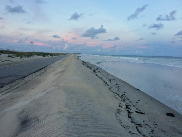
There are also reports of high tide overwash on Pea and Hatteras Island.
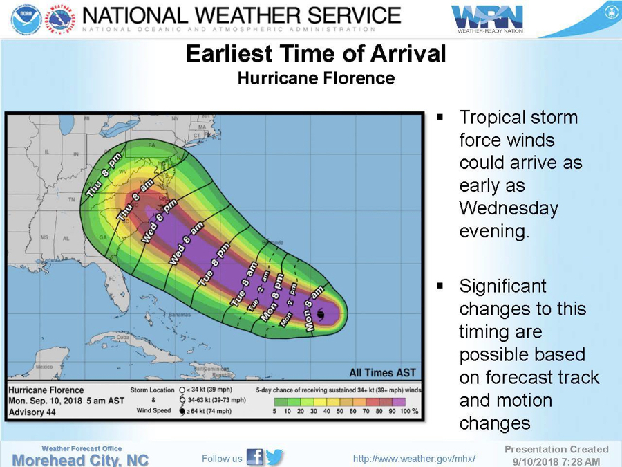
The National Weather Service reports today that Hurricane Florence has strengthened overnight into a Category 2 Hurricane, and she will continue to rapidly intensify over the next couple days.
Florence is still expected to make landfall somewhere along North or South Carolina as a major hurricane Thursday night. Confidence continues to increase in Eastern N.C. seeing significant to life threatening impacts from this storm.
Track and intensity information for Florence can be found by visiting the National Hurricane Center at www.nhc.noaa.gov and local forecast information is available at www.weather.gov/mhx.
The N.C. Division of Marine Fisheries is asking fishermen to keep a close eye on the progress of Hurricane Florence and to start getting ready for the storm now.
Gov. Roy Cooper has declared a state of emergency for North Carolina and is urging North Carolinians to prepare for the storm.
Fishermen should remove fishing gear from the water well before the storm’s arrival. Crab pots and gill nets, especially, are prone to damage and displacement during storms.
Vessel owners should check their safety equipment to ensure all is in working order and plan to remove their boats from the water or take them to safe harbor as the storm approaches.
Fishermen should monitor NOAA Weather radio for storm updates and channel 16 on their marine radios for the latest U.S. Coast Guard emergency broadcasts.
Information about other hurricane preparations, as well as a free mobile app, can be found on the state Division of Emergency Management’s website at www.ReadyNC.org.


