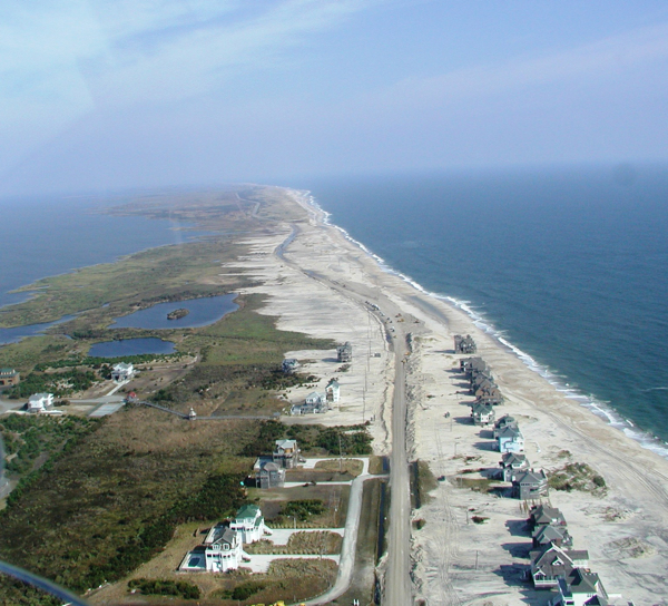
The shoreline of the Outer Banks in Pea Island National Wildlife Refuge is one of the most dynamic on the East Coast, and to keep the tenuous link NC 12 offers to visitors and residents of Hatteras Island open takes tremendous effort and imagination. This article from the Island Free Press expands on the beach nourishment bids just accepted to protect the S Curves and includes information about NCDOT plans for the road.

“The U.S. Army Corps of Engineers On Friday, June 20, opened bids from contractors for an N.C. Department of Transportation project to nourish the beach north of Rodanthe on Hatteras Island and provide protection for a vulnerable stretch of Highway 12.
Multiple bids were received. The Army Corps will now review each bid to ensure it meets all requirements, and it expects to award a contract by mid-July. More information on the bids can be found online.”
[box type=”bio”] To learn more about what the state and federal governments are doing to protect access to Hatteras Island, click HERE.[/box]
